Paris Metro: Navigate the City of Light Like a Local
Culture Travel may earn a commission through links on this website. As an Amazon Associate, we earn from qualifying purchases.
Today I’m taking you into the heart of France’s enchanting capital, Paris, focusing specifically on the Paris Metro – an efficient and surprisingly easy way to navigate the City of Lights.
Whether you’re visiting Paris for the first time or just seeking to gain more confidence in using its public transport system, this guide will help you smoothly navigate the sprawling labyrinth that is the Paris Metro.
With over 300 stations and 16 lines, it might seem a bit intimidating initially. But once you’ve mastered the basics, you’ll soon be whizzing through the underground tunnels like a local, ready to enjoy every croissant, every architectural gem, and every hidden art corner that Paris has to offer.
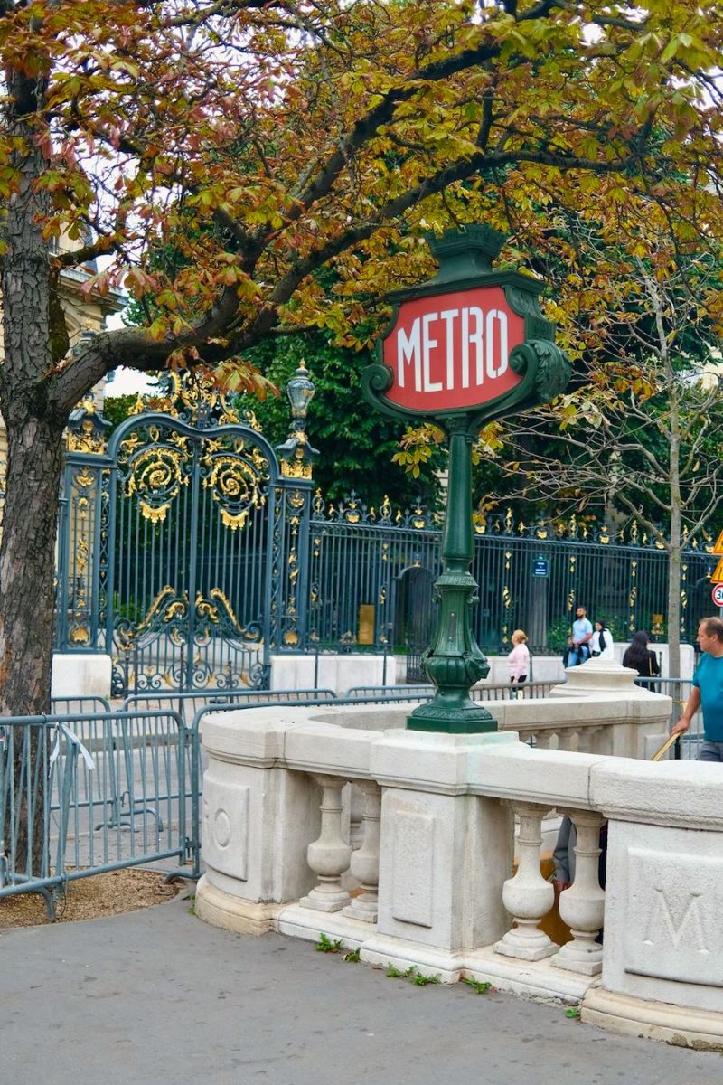
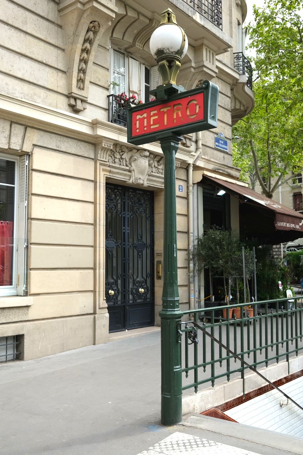
The Paris Metro, with its art nouveau entrances and rich history dating back to 1900, is more than just a transport system. It’s an integral part of the Parisian culture and a reflection of the city’s charm itself.
So, buckle up as we dive into this comprehensive guide, preparing you to take on the Paris Metro for the first time. By the end of this post, you’ll have all the tools you need to decode the Metro map, understand ticketing options, plan your journey, and avoid common pitfalls. Enjoy the ride!
RATP
The first thing you must know about the Paris Metro is that it’s run by what’s known as the RATP.
RATP, which stands for “Régie Autonome des Transports Parisiens,” is the state-owned public transport operator responsible for most of the public transportation in Paris, France, and its surrounding Île-de-France region.
The RATP’s services include the Paris Metro, tram and bus services, and parts of the RER, the regional express network.
Established in 1948, the RATP is one of the largest public transport operators in the world. Its network is crucial to the functioning of Paris, serving millions of residents, commuters, and tourists every day.
The RATP not only provides public transportation services but is also responsible for maintaining the network, ensuring its safety, and developing new infrastructure and services. Its official website and mobile application offer journey-planning services, maps, and real-time traffic information.
Paris Metro Map
You can find the Paris Metro Map in a few places:
RATP’s Official Website: RATP provides detailed maps of the Metro system on their official website.
Here is a high-res image file you can view from anywhere: https://www.ratp.fr/sites/default/files/plans-lignes/Plans-essentiels/Plan-Metro.1669996027.png
Paris Tourist Information Centers: If you’re already in Paris, the local tourist information centers provide free maps. You can usually find these at airports, train stations, and major tourist areas.
Mobile Apps: There are several mobile applications that offer interactive Metro maps and can also help plan your journey. Some popular options include ‘Paris Metro’ by Mapway, ‘RATP: Bus Metro RER’, and ‘Citymapper’.
Google Maps: This platform is always a good tool for navigation. If you have an internet connection, Google Maps can provide you with the Metro lines, transfer points, and estimated travel times.
Paris Metro Lines
The Paris Metro system consists of 16 lines, each of them identified by a number and a distinct color on the Metro map:
- Line 1 (Yellow): La Defense ↔ Château de Vincennes
- Line 2 (Blue): Porte Dauphine ↔ Nation
- Line 3 (Olive Green): Pont de Levallois – Bécon ↔ Gallieni
- Line 3bis (Lavender): Gambetta ↔ Porte des Lilas
- Line 4 (Mint Green): Mairie de Montrouge ↔ Porte de Clignancourt
- Line 5 (Orange): Place d’Italie ↔ Bobigny – Pablo Picasso
- Line 6 (Lime Green): Charles de Gaulle – Étoile ↔ Nation
- Line 7 (Pink): La Courneuve – 8 Mai 1945 ↔ Mairie d’Ivry/Villejuif – Louis Aragon
- Line 7bis (Aqua): Louis Blanc ↔ Pré-Saint-Gervais
- Line 8 (Purple): Balard ↔ Créteil – Pointe du Lac
- Line 9 (Light Brown): Pont de Sèvres ↔ Mairie de Montreuil
- Line 10 (Yellow-Green): Boulogne – Pont de Saint-Cloud ↔ Gare d’Austerlitz
- Line 11 (Brown): Châtelet ↔ Mairie des Lilas
- Line 12 (Green): Front Populaire ↔ Mairie d’Issy
- Line 13 (Blue-Violet): Asnières – Gennevilliers – Les Courtilles/Saint-Denis – Université ↔ Châtillon – Montrouge
- Line 14 (Dark Red): Mairie de Saint-Ouen ↔ Olympiades
The metro lines are not solely based on a point A to point B principle. Some lines have multiple termini, like line 7 and 13, which branch off towards the end of the lines.
Paris Metro Stations
How many metro stations are in Paris? the Paris Metro system boasts 302 stations (not including the RER network). This makes it one of the densest metro systems in the world in terms of stations per square kilometer.
Major Paris Metro Stations
What are the major metro stations in Paris?
There are numerous key stations in the Paris Metro network. These stations are often important due to their central location, or because they serve as major connection points between various lines. Here are some of the most important stations:
Châtelet – Les Halles: This is the largest underground station in the world and serves as a major hub in Paris. It connects Metro Lines 1, 4, 7, 11, and 14, as well as three RER (suburban express railway) lines A, B, and D.
Gare de Lyon: This station serves Metro Lines 1 and 14, and RER Lines A and D. As one of the six large mainline railway station termini in Paris, it provides access to a substantial part of the French railway network.
Gare du Nord: It connects Metro Lines 2, 4, and 5, and RER Lines B, D, and E. Gare du Nord is also the station for the Eurostar with trains to London and other international destinations.
Gare Saint-Lazare: This station serves Metro Lines 3, 12, 13, and 14, and is also one of the six large termini of the mainline railway network in Paris.
Gare Montparnasse: Serves Metro Lines 4, 6, 12, and 13, and is a terminus for numerous trains heading towards the west and south-west of France.
Charles de Gaulle – Étoile: This station serves Metro Lines 1, 2, and 6, as well as RER Line A, and is located underneath the Arc de Triomphe.
Franklin D. Roosevelt: An important station located near the Champs-Élysées, connecting Metro Lines 1 and 9.
These stations provide access to many of the most popular and important sites in Paris, including the Eiffel Tower, Louvre Museum, Montmartre, Champs-Élysées, and more.
Eiffel Tower Station
The Eiffel Tower is accessible by two Metro stations
- Bir-Hakeim: This is the closest Metro station to the Eiffel Tower. It is on Line 6 (Lime Green), and it’s just a short walk from the station to the tower.
- Trocadéro: Located on Lines 6 (Lime Green) and 9 (Light Brown), Trocadéro station is a bit farther away but offers a stunning view of the Eiffel Tower as you exit the station and walk towards it across the gardens of the Trocadéro.
You can also use the RER, a high-speed train service that operates in the Paris metropolitan area. The closest RER station to the Eiffel Tower is “Champ de Mars – Tour Eiffel” on RER Line C.
Famous Metro Stations
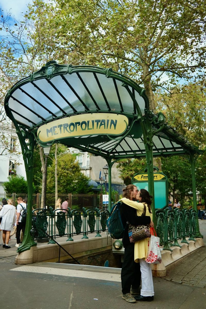
What is the most famous metro station in Paris? While there are many notable and iconic stations in the Paris Metro, one that often stands out as particularly famous is the “Abbesses” station.
Located in Montmartre in the 18th arrondissement and serving Line 12, Abbesses is known for its Art Nouveau entrance, designed by Hector Guimard.
It’s one of the two original Guimard entrances left in Paris (the other being at Porte Dauphine) and is the deepest station in the Paris Metro network, at 36 metres (118 feet) below ground. This gives it a long spiral staircase (though there is also an elevator if needed).
Apart from Abbesses, other iconic stations include:
- Arts et Métiers: It’s known for its Jules Verne-inspired, steampunk interior design.
- Concorde: The walls of this station are covered with tiles spelling out the entire “Déclaration des droits de l’homme et du citoyen de 1789” (Declaration of the Rights of Man and of the Citizen of 1789).
- Cité: It has a unique and atmospheric architectural design with its white tiles and lighting.
All these stations are famous for their unique design elements, representing different aspects of Parisian history and culture.
Paris Metro Travel Times
How often do metro trains run in Paris? The exact travel times on the Paris Metro can vary depending on the specific day and time due to factors such as traffic, delays, and maintenance work.
In general, the intervals for the Paris Metro trains run about every 2-4 minutes during peak times and every 5-7 minutes off-peak.
Here are some approximate travel times between popular stations to give you an idea:
Châtelet – Les Halles to Eiffel Tower (Bir-Hakeim): About 20-25 minutes on Line 1, with a transfer at Charles de Gaulle – Étoile to Line 6.
Gare du Nord to Notre Dame (Cité): About 10-15 minutes on Line 4.
Gare de Lyon to Louvre Museum (Palais Royal – Musée du Louvre): About 15 minutes on Line 1.
Gare Montparnasse to Champs-Élysées (Franklin D. Roosevelt): About 15 minutes on Line 13, with a transfer at Invalides to Line 8.
Charles de Gaulle – Étoile (Arc de Triomphe) to Montmartre (Abbesses): About 20-25 minutes on Line 2.
Is the Metro 24 hours in Paris? No, the Paris Metro does not operate 24 hours a day. The Metro typically begins operation around 5:30 AM and runs until about 1:15 AM on weekdays and Sundays. On Fridays, Saturdays, and days before a public holiday, the service extends until about 2:15 AM.
Paris Metro Tickets & Fares
How do you pay for the metro in Paris? Paying for the Paris Metro involves purchasing tickets or passes via a physical machine installed in the station or via the RATP mobile app.
Here are the types of Paris metro tickets:
Single-use Ticket: Known as the “t+ ticket”, this can be used for a single continuous journey across the Metro system, including between Metro and RER within Paris. These small paper tickets are slowly being phased out, but most stations still accept them.
Navigo Easy: A reusable, top-up card that you can load with t+ tickets or other types of tickets. This is what I use. It can be reloaded via the RATP app.
Carnet: This is a pack of 10 “t+” tickets sold at a discount. They can be shared among multiple people.
Mobilis Day Pass: A day pass valid for unlimited travel within certain zones.
Paris Visite Travel Card: Designed for tourists, this pass offers unlimited travel for 1, 2, 3, or 5 consecutive days in zones 1-3 or 1-5.
Navigo Week/Month Pass: For frequent travelers or residents, these passes offer unlimited travel for a week or a month, respectively, but the week pass is valid from Monday to Sunday only.
Tickets and passes can be purchased at ticket offices and machines located at every Metro station, at some tobacconists, and via the RATP’s official app. If you’re buying from a ticket machine, note that some machines only take coins or European credit cards with a chip.
Costs
How much does a metro ticket cost in Paris? The cost of a single t+ ticket for the Paris Metro was 1.90 euros if purchased individually. If you buy a “carnet,” which is a pack of 10 t+ tickets, the cost was 16.90 euros, making each ticket effectively 1.69 euros.
How much is a day metro ticket in Paris? For unlimited travel, you might consider a travel pass such as the Mobilis or the Paris Visite card. The Mobilis day pass cost starts at 7.50 euros for Zones 1-2 and goes up to 17.80 euros for Zones 1-5 (as of 2021).
The Paris Visite card, which is geared towards tourists, ranges from 12.00 euros for a 1-day pass for Zones 1-3 up to 65.80 euros for a 5-day pass for Zones 1-5.
Always Keep Your Ticket With You!
An important thing to know is that you absolutely need to keep your rechargeable card or ticket with you throughout the duration of your trip on the Paris metro. While it’s rare, RATP employees occasionally walk through and ensure everyone has paid for their trip using a machine and you need to let them scan your ticket to prove that you did, to avoid a fine!
Paris Metro Route Planner
There are several online tools and mobile applications that can help you plan your route on the Paris Metro:
- RATP Official Website and App: The RATP’s own tools can provide accurate, up-to-date information about Metro routes, schedules, and any disruptions or works. They also offer real-time updates and alerts. The app can be downloaded from the App Store or Google Play.
- Google Maps: This tool is very user-friendly and familiar to many people. It shows Metro lines, gives several route options, and includes approximate travel times, including walking to and from stations.
- Citymapper: Known for its easy-to-use interface and real-time updates, Citymapper is a popular option for navigating public transport in many cities around the world, including Paris. It can suggest the best routes based on your location and destination, and includes Metro, bus, tram, RER, and even walking and biking options.
- Moovit: Similar to Citymapper, Moovit provides real-time updates and step-by-step guidance for navigating public transport networks. It covers over 2700 cities, including Paris.
- Next Stop Paris: This is the RATP’s app specifically designed for tourists. It works offline and provides information about the best way to reach Paris’s top attractions, including journey times and service status.
Remember to download any necessary apps and maps before your trip, especially if you won’t have reliable internet access while you’re out and about in Paris.
Paris Metro App
The official Paris Metro App Bonjour RATP is managed by the RATP, which is the company responsible for managing public transportation in Paris. This app is designed to provide comprehensive real-time information for planning trips across the RATP’s extensive network, which includes the Metro, tram, bus, and RER services.
The app can calculate the best routes for your journey, provide estimated travel times, and suggest alternative routes. You can receive real-time information about departures, delays, and disruptions, helping you plan more effectively and avoid unexpected issues.
The app includes detailed, interactive maps of the RATP network, which can be helpful for visualizing your journey. You can save your favorite stops and routes for quick access, and the app keeps a history of your recent searches.
Best of all, you can buy tickets for your Navigo pass via the app!
Interesting and Little-Known Facts
The Paris Metro is one of the oldest, busiest, and most extensive subway systems in the world, and it has a rich history and many interesting facts associated with it. Here are a few:
The first line of the Paris Metro was opened in 1900 during the World’s Fair (Exposition Universelle). The inaugural line was Line 1, which ran between Porte Maillot and Porte de Vincennes.
Many Metro entrances are notable for their Art Nouveau architecture, designed by Hector Guimard. Today, only two original Guimard entrances remain: Porte Dauphine and Abbesses.
The Metro network is primarily located underground, with the deepest station, Abbesses on Line 12, lying 36 meters (118 feet) below ground.
Some stations have unique decorations to reflect the area’s history or significance. For example, the Louvre-Rivoli station has replicas of the museum’s artwork, and the Arts et Métiers station is designed to look like a submarine in homage to the works of Jules Verne.
The Metro has a few “ghost stations” that are no longer in use. The most famous of these is the Croix-Rouge station, which closed at the start of World War II and never reopened.
The average distance between stations on the Paris Metro is only 562 meters, which is one of the shortest in the world. This makes it convenient but also contributes to relatively slow average speeds.
Metro vs. RER
The Paris Metro and the RER (Réseau Express Régional) are both integral parts of Paris’s public transportation system, but they serve slightly different purposes and have different characteristics.
The Metro is primarily designed for travel within Paris itself. It covers the city very densely with 16 lines and over 300 stations. The Metro is usually simpler for tourists to use because it’s less likely that you’ll need to navigate fare zones or validate tickets in a particular way.
The RER is a regional express network that connects central Paris with the wider Île-de-France region, including destinations like Versailles, Disneyland Paris, and both Charles de Gaulle and Orly airports. RER trains are less frequent than Metro trains, typically arriving every 10-20 minutes, but they are faster because the stations are further apart. RER trains are larger and often double-decker, which can make them more comfortable for longer journeys.
Both the Metro and RER are part of the same ticketing system, so you can transfer between them freely within Paris (Zone 1) on a single t+ ticket. Just make sure to keep your ticket until you’ve completed your journey, as you may need to re-insert it into the turnstiles when transferring or when exiting RER stations.